IRUMUGARRIETA
Lizarrusti - Irumugarrieta - Lizarrusti
Duration: 6 hours 30 min
Maximum altitude: 1.424m
Climb/descent: +1035/-1035 m
Distance: 23,5 km
Circular route: yes
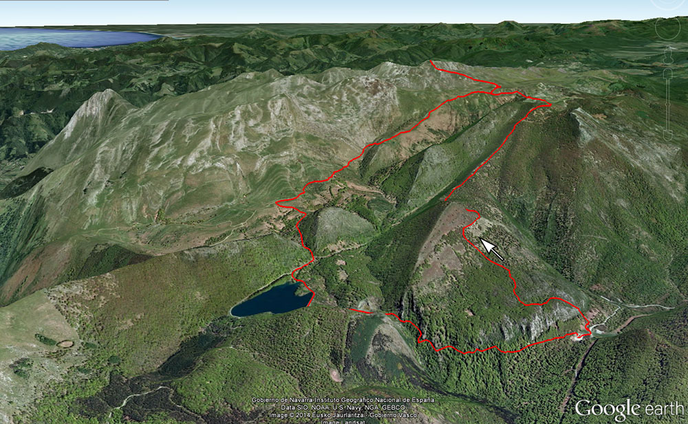
Starting point: Lizarrusti Parketxea
Path starts at the back of the shelter and follows the GR121 trough Igaratza fields. In his first half, it passes permanently under beeches. Later, already in Igaratza's surroundings and up to Irumugarrieta's top, pastures and rocky areas are combined. Exiting Igaratza, take to the right leaving the GR121 and line up towards the north, following the border between Navarre and Gipuzkoa until reaching the top.
Descend by the same itinerary up to Igaratza and in this point, leave the route of raise and go west, towards Enirio. Then, continue south direction by the pass between Sattari and Akaitztxiki peaks, to exit to the swamp of Lareo. Cross over the dam and take the well signposted way that he returns to Lizarrusti.
Itinerary without clear way between Igaratza and and Irumugarrieta. Indispensable gps track or map/compass and good sense of the orientation. Caution, very difficult to orient in case of fog.
VIEW MAP
DOWNLOAD FILES
GPX file for GPS devices: Download